A severe thunderstorm watch is a sign that a hot, unstable air mass is ready to turn dangerous fast. Strong wind, hail, lightning, and sudden downpours can follow quickly after record warmth, making the evening commute and outdoor plans a concern.
weather alerthailsevere stormssevere thunderstorm watchthunderstorm forecaststrong windslightningspring storms

A severe thunderstorm watch is often the first clear signal that a quiet, hot day can turn rough in a hurry. When warm, humid air collides with a stronger storm system, the atmosphere can go from summerlike calm to damaging winds, hail, and frequent lightning in a short window. That is the main story behind this round of storm risk: a stretch of early-season heat has set the stage for thunderstorms that could become severe once the heat breaks.
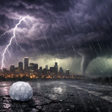
The setup is a familiar one for spring and early summer. Temperatures climb into the upper 80s or near 90, humidity rises, and the air becomes increasingly unstable. Once a front or upper-level disturbance arrives, storms can fire along the boundary and intensify quickly. Forecast guidance has pointed to a broad area of instability and enough wind shear to support organized storms, including cells capable of producing large hail, damaging wind gusts, and, in some regions, tornadoes. Even when the main threat is wind, the impacts can be immediate and disruptive.
That is why a severe thunderstorm watch matters. It does not mean every location will see severe weather, but it does mean conditions are favorable for it. People in the watch area should expect storms to develop or move in with little warning. The biggest hazards are often the ones that arrive fastest: a sudden burst of wind that knocks down branches, lightning that forces outdoor events to stop, and downpours that reduce visibility on roads. In a busy afternoon or evening, those changes can cause serious problems in minutes.
The timing is especially important. Storms that arrive during the late afternoon or evening can collide with commutes, school pickups, errands, and outdoor plans. Forecasters often emphasize that strong storms at this time of day can be more dangerous because roads are crowded and people are still out and about. Heavy rain can pond on streets, wind can make driving difficult, and lightning can create hazards for anyone caught outside. A watch is a reminder to finish travel early if possible and to have a way to receive warnings if conditions worsen.
The broader weather pattern has also supported a more active stretch. Forecast discussions have described a moist and unstable air mass, a strengthening low-level jet, and deep-layer wind shear that can help storms organize. When those ingredients line up, storms are more likely to persist and intensify rather than quickly fall apart. That can mean clusters of thunderstorms, supercells, or a line of storms with strong wind potential. In the most favorable environments, the severe threat can spread across a large area rather than staying isolated.
Recent forecasts have also pointed to a dramatic contrast between the heat and the storms. One day may feel like the warmest of the season so far, while the next brings a sharp cooldown and a much more unsettled sky. That kind of swing is common when a front pushes through after a hot spell. The same warmth that makes the day feel summery also helps fuel the storms that arrive later. Once the front passes, temperatures can settle back toward seasonal levels, but not before the atmosphere has had a chance to unload.
For people under a severe thunderstorm watch, the practical advice is straightforward. Secure loose outdoor items, charge phones and backup batteries, and review where to go if a warning is issued. If storms approach, move indoors well before the rain starts. A sturdy building is the safest place during lightning and severe wind. Avoid sheltering under trees, and do not try to outrun a storm in a vehicle if heavy rain or hail is already falling. If driving becomes dangerous, slow down, turn on headlights, and be prepared to pull over safely if visibility drops too far.
The watch also serves as a reminder that severe weather is not limited to tornado headlines. Many of the most damaging storms are the ones that produce straight-line winds, hail, and repeated lightning strikes. A few minutes of intense wind can take down tree limbs or power lines, and hail can damage cars, roofs, and crops. Even a storm that never reaches tornado strength can still create a dangerous situation for anyone outdoors or on the road.
In some places, the storm risk is paired with a broader pattern of unsettled weather that lasts beyond one evening. That can mean another round of showers or storms later in the week, especially if the atmosphere remains moist and warm. When the forecast stays active, the first watch is often only the beginning of a period that requires close attention. The key is not to focus only on the first line of storms, but on how the pattern evolves over the next day or two.
The bottom line is simple: a severe thunderstorm watch is a heads-up that the atmosphere is primed for dangerous storms. After a hot stretch, the arrival of a front can trigger fast-building thunderstorms with strong wind, hail, lightning, and heavy rain. The watch gives people time to prepare before warnings are issued. That preparation can make the difference between a routine stormy evening and a hazardous one.